By Mario Russel

The village of Charlottleville located at the northeastern tip of Tobago is the number one destination for eco-tourism in Tobago.
The area was once a cacao estate owned by the Turpins since 1865. They have resold and leased much of the land to the villagers who are descendents of the estate workers.
On the 7 th of June 2022, the northeastern part of Tobago has been declared a UNESCO Man
and the Biosphere Reserve. It simply means the eco-system which extends 83,488 hectares
(terrestrial 15,104 ha, marine 68,384h) from Moriah to Charlotteville and as far south as
Roxborough has to be protected and should not be cut down.
The coast which extends several miles out to sea is also included in the reserve. It includes the islands of Little Tobago and St Giles. The vast marine area hosts coral reefs, mangroves and underwater
species of exotic marine life such as manta rays etc. Tobago’s North-east region is the
largest UNESCO Biosphere in the English-speaking Caribbean, the only larger reserve is
located on the French-speaking island of Guadeloupe. It is home to endangered plants and
animals which includes 83 endangered species and 41 endemic species. In addition, the
forest protects against soil erosion and provides significant carbon expulsion.

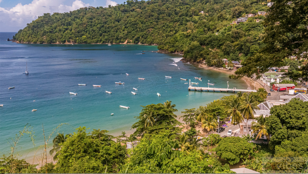
Charlottesville is a safe place for visitors and village folks are friendly. The villagers make
their living from fishing and it is one of the cheapest places to purchase fish in the
country. Situated at the centre of the town is the expanded jetty, where seagulls and
magnificent frigate birds fight for fish remains. Located in the village there are a Fishing
Depot, a Customs House, Police Station, Library and Football Field. Just open along the main
bypass there is a newly built shopping centre. There are no towering buildings or hotels in
Charlotteville; instead, there are guesthouses, beach cottages, and apartments.
The vast seascape is known as Man-O-War Bay and within its perimeter are several smaller
bays. Because of the deep waters surrounding Man-o-war Bay, it was an ideal location for
sugar transhipment. The Charlotteville Estate, which spanned 11,000 acres and stretched
from Campbleton in the west to Starwood in the east, as well as over the hills to Pirates Bay
and Iguana Bay, was the dominant estate in the region. A sugar storage facility may still be
seen at Campbleton Bay, and the water wheel that was used to crush the cane can still be
seen at Tyrell’s Bay in Speyside. The coastal scenery of fishing vessels with their rods
hanging is enhanced by a backdrop of tall mountains.

Non-hikers will find Charlottleville to be very relaxing. A barefoot walk along the
beach can be soothing and therapeutic. There is the option to take the boat and explore
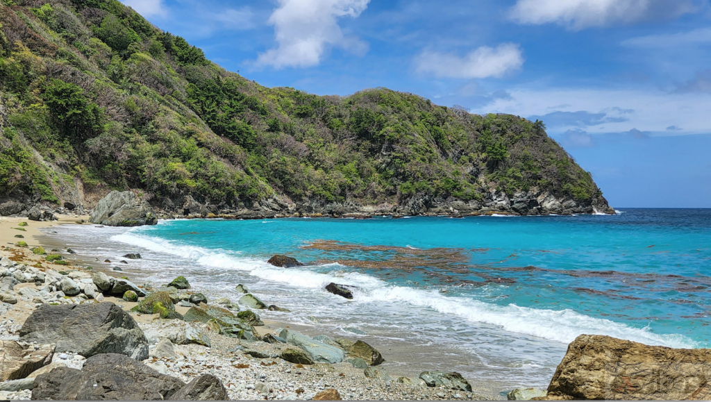
some of the remote beaches such as Lovers Bay or Pink Sand Beach and Waterfall Bay.
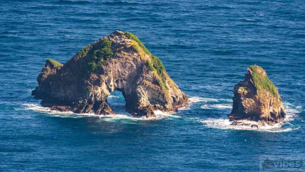
Iguana Bay is a secret gem located in the rough waters around the coast opposite St Giles
Island and London Bridge Rock.
Fishermen can take you on fishing tours and in Charlottleville there are fishing tournaments. The fishermen use a fishing technique known as trolling where one or more fishing lines with baited hooks or lures are attached to a rod and connected to a boat and towed through the water to catch fish. The boat moves at a slow or moderate speed, dragging the baited lines through the water to attract and catch fish. Popular fish caught are the king, mahi mahi and tuna.
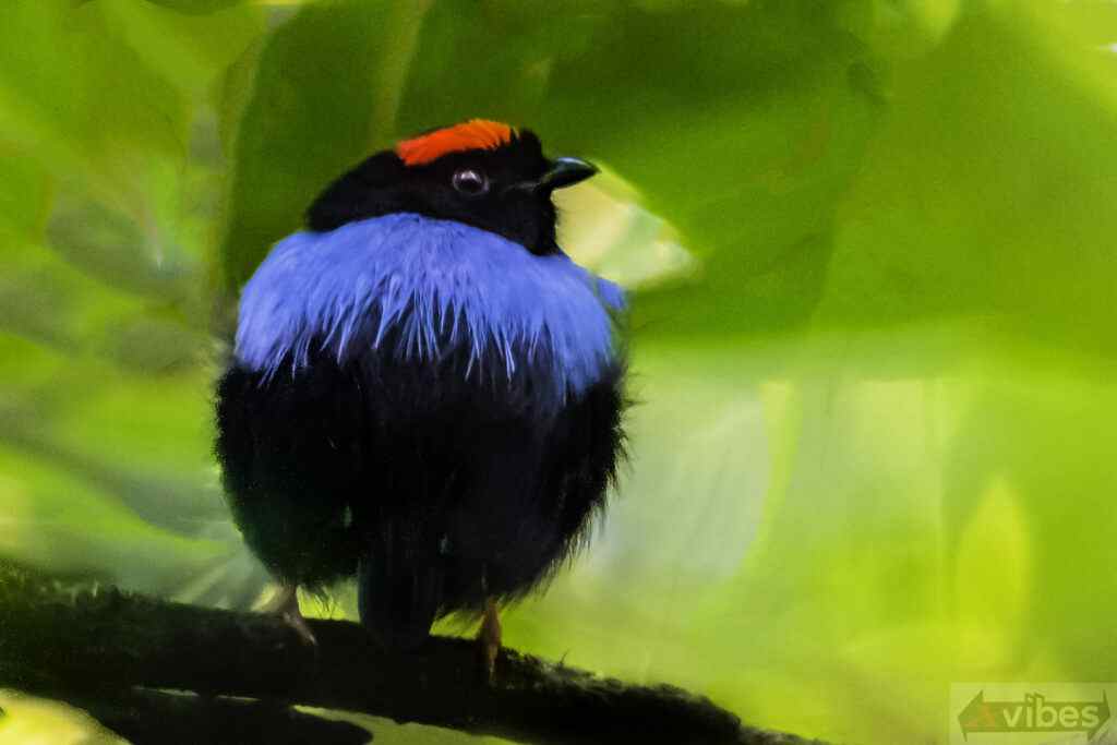
Charlottesville is also a place to do some bird watching. Some rare birds exclusive to
the area are the Great Black Hawk, White-tailed Sabrewing, Mot Mot and Blue-backed
Manakin. For some unknown reason black vultures don’t frequent Tobago and in recent times only one has been spotted.

Hiking
Charlottleville has numerous places to hike and one can spend weeks exploring the
numerous nature trails. The easiest of all hikes is the short walk over the hill to Pirates
Bay. I have included below a list of hikes that can be done from the village and their ratings.
Because the trails are not well maintained, it is very easy to get lost. I strongly recommend a
guide since there are no signs and the trails are not marked.
1. From the Village to Flagstaff Hill 366m (1200ft). This can be done as a loop hike
where you take the road up to Flagstaff Hill and return downhill via a forest trail.
Rated 4 moderate, Hiking time 1 1/2 hrs.
2. From the village to Fort Campbelton and a downhill walk to Campbelton Bay. 30-
45 mins. Rated 3 fair.
3. From the village to Waterfall and Deadman Bay. Although the walk to the bay is
downhill, leaving the ridgeline to get down to the bay has some steep areas. Hiking
time at least 1 1/2 hr Rating 5 moderately challenging.
4. From Fort Campbelton a steep uphill climb that will take you along the ridge
where you can hike to Pool of Siloam 442m (1450ft) and to Hermitage Peak also
called Check Point Charlie 2183 feet or 530m. Rated 6 Strenuous, hiking time is 3 hrs
one way.
5. Hikes from the village can be done to Manowar Hill 549m (1800ft), and Pigeon
Peak 500m ((1640ft). There is the option to descend to the Speyside Lookout. Hiking
time is 2-3 hrs one-way and strenuous.
6. On the Northern tip of Charlottleville the vast landscape known as Starwood.
There are numerous valleys to trek and they offer great views of St Giles Island and
London Bridge.
